
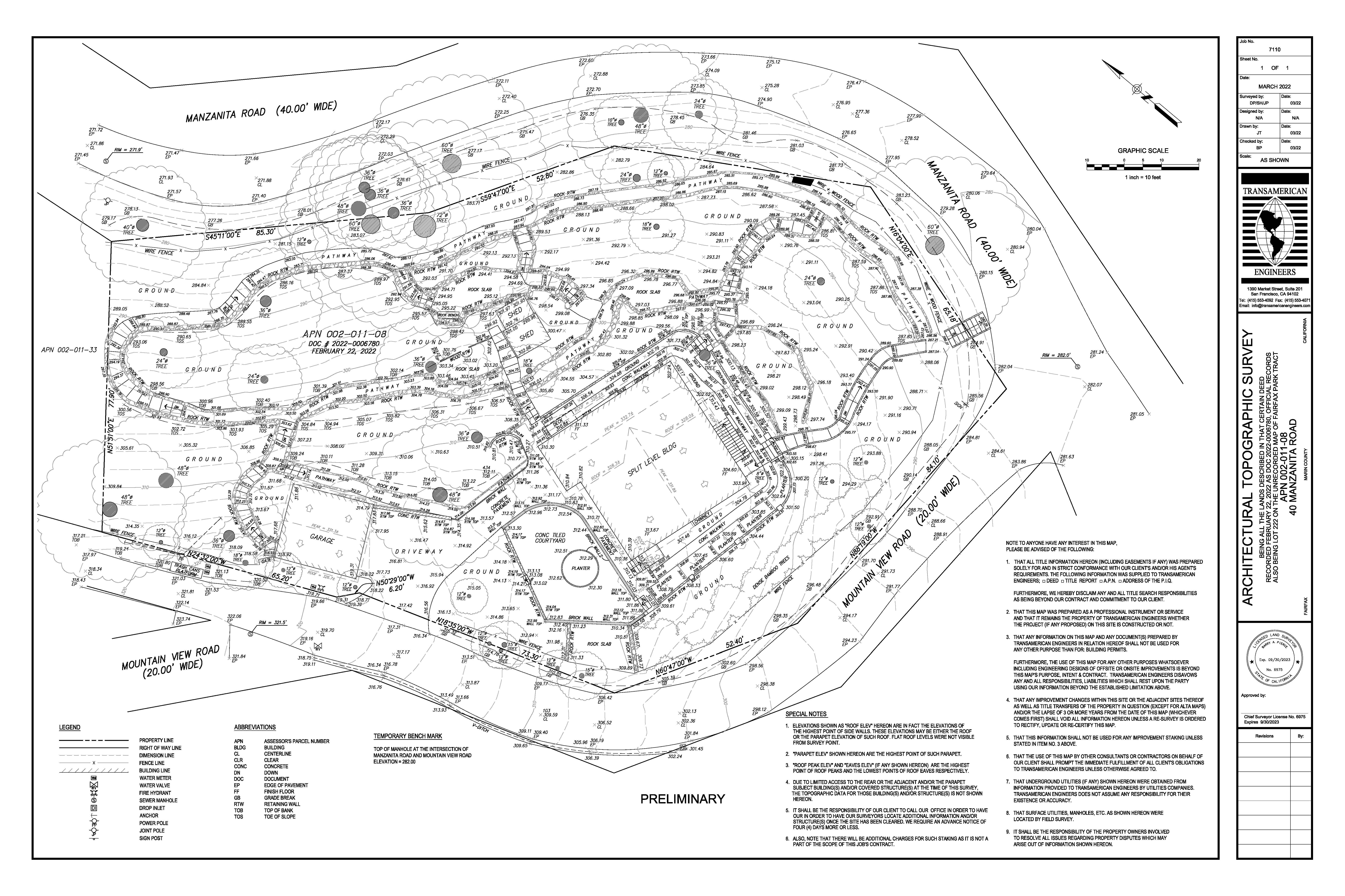
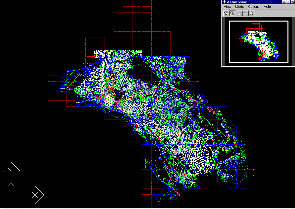
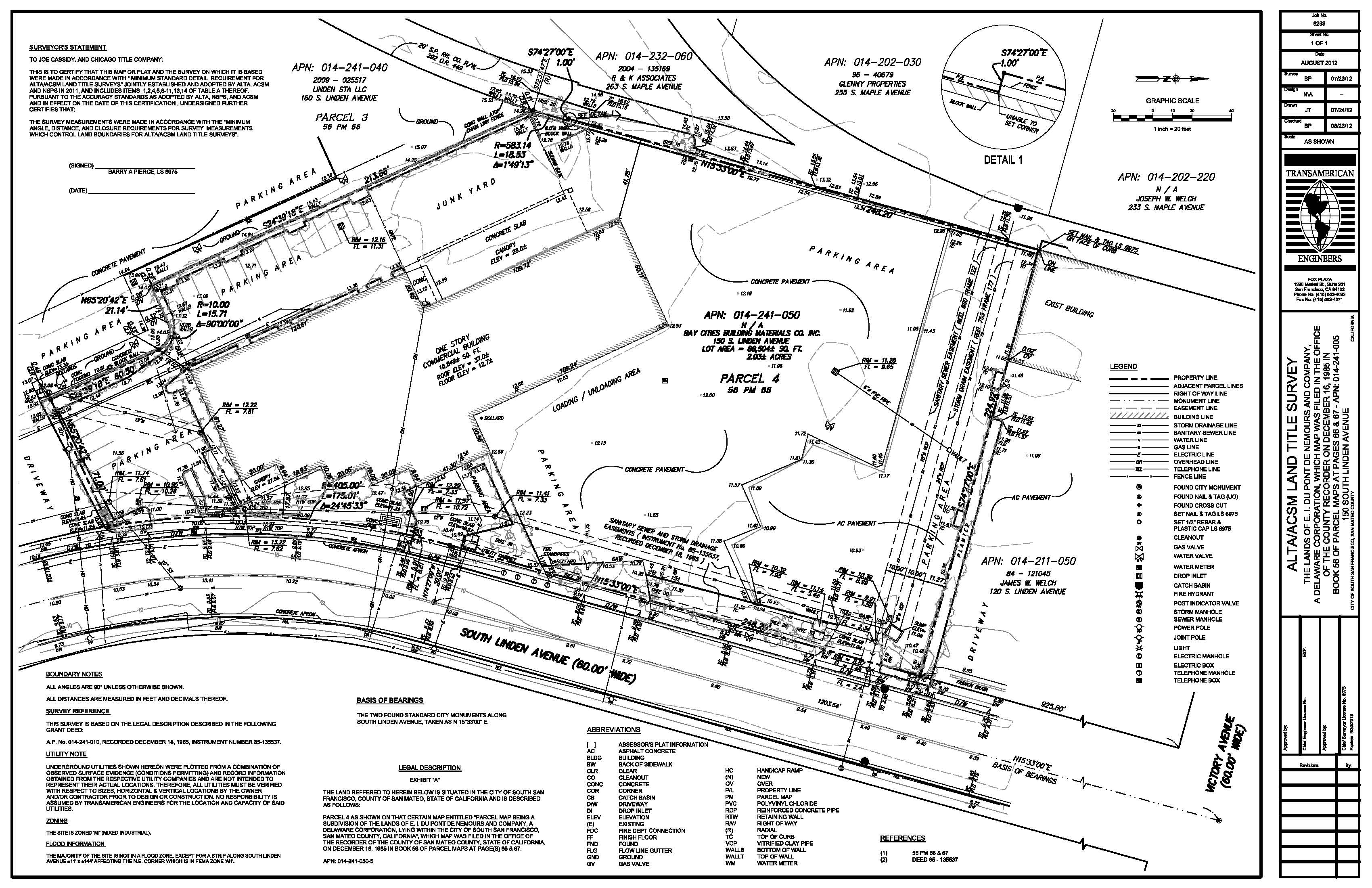
3D Scanning (Lidar) TAE remains on the cutting edge of new technology. Our LIDAR 3D Scanner allows us to offer clients pre-construction survey imagery as well as photo documentation of the process during construction and as-built surveys. TAE also offers a broad range of GIS services, including GIS data compilation, data conversion, satellite image and photo interpretation, data translation, cartographic plotting and much more.